The weather has been dreadful. Last Tuesday was supposed to be a nice day, but we had quite a bit to do in the morning (Aldi etc). I managed a walk up to St. Annes and back and the weather was nice but the walk was not what I needed.
Heather had stuff to do on the Wednesday but I was free, so I decided on the old stand-by, the Rag Pudding Walk, a walk exploring Darwen’s reservoirs.
I’m on my way!
The day started with me getting up feeling lethargic but, after a quick kick up the backside (mental), I got myself organised and left. Disaster struck first in Lytham where both pie shops were shut!! I picked up a pack of butties in Booths and carried on to Warton. There the second disaster struck. I hadn’t pumped the tyres up for a while, so called in to the garage only to find the machine has a minimum spend of £1!!! Outrageous, I thought, but pumped them up anyway.

I drove off to Darwen (medium sized town), a typical East Lancashire mill town. I was expecting the lamp posts to be decorated with flags, and there were quite a few. I have to say however that, per capita, there are probably more in Freckleton (small village near Lytham). I think the flag hangers all should be locked up, but this is a walk post, not a politics post.
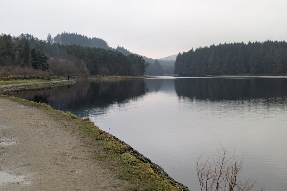
Turton and Entwistle Reservoir
It was gloomy at the car park by the reservoir but once I started walking, I was in my happy place. Hills, trees (Forestry Commision fir trees, but never mind) and lakes…. what could be better. I had intended to vary my normal route and try and find the actual Warper’s Trail. This is one of four circular routes based on the Witton Weaver’s Way, which has been mentioned before in these blog posts. Unfortunately this plan was scuppered slightly by either poor map reading or Forestry Commision planting obscuring the route. As I know the area pretty well this didn’t matter and the route was adapted.
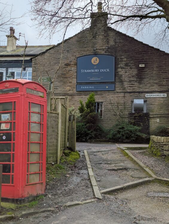
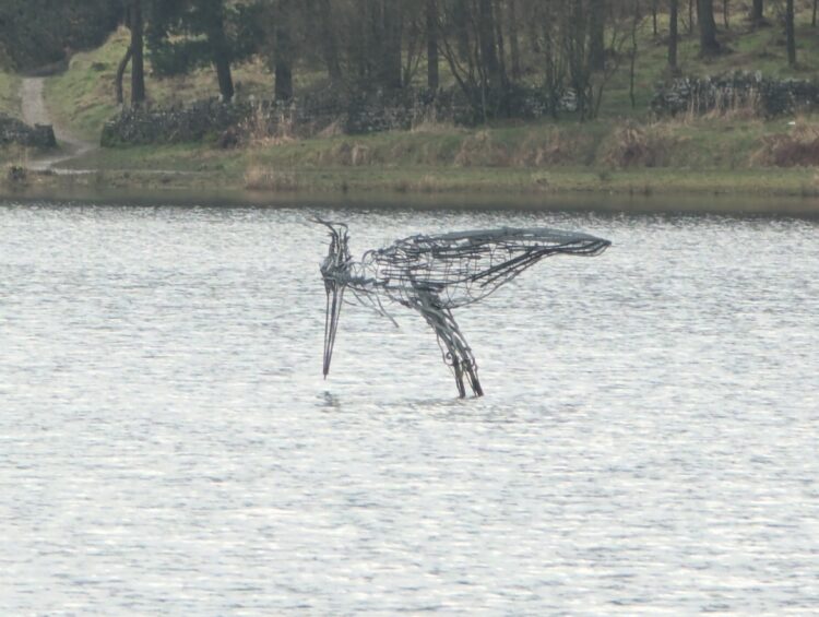
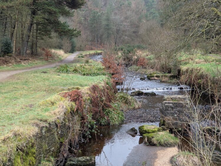
I walked around the south side of Turton and Entwistle Reservoir and then through Fox Hill Plantation on the north side to emerge near the heron statue. I then followed the lake shore before cutting up the hill to New House Farm and then the famous Strawbury Duck pub.
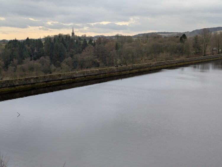
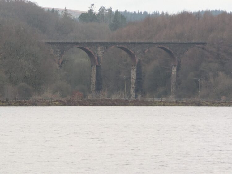
Wayoh Reservoir
After passing Entwistle railway station, I dropped down to the second reservoir of the day, Wayoh. Following the east bank, I finally reached the dam and the Black Bull, home of the rag pudding. I should point out here, I have had a nicer rag pudding than that served at The Black Bull, but it was quite a bit more expensive and much further away. On this occasion, however, as I mentioned before, sandwiches were the order of the day.
Edgworth
I had only previously walked quickly through Edgworth, but, as I was alone, I decided to explore a little and take a few photos. Apparently this small town at one point was home to fourteen factories related to the cotton industry. It was also an overnight stop for Mahatma Ghandi when he visited Lancashire in 1931.
Industrial Archaeology
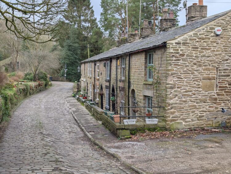
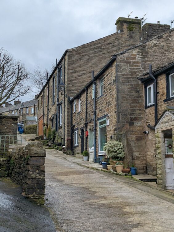
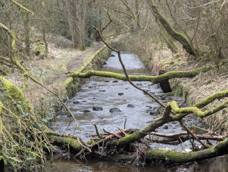
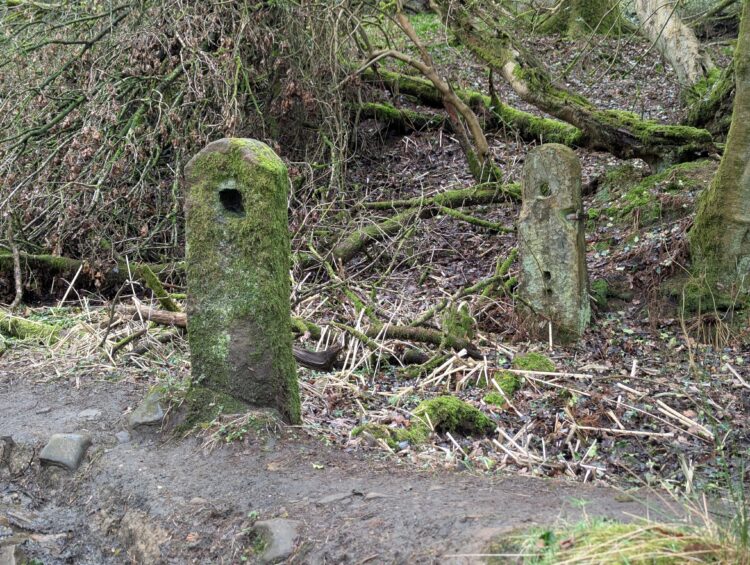
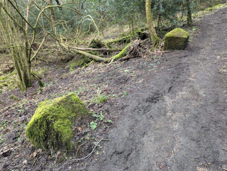
Canalised rivers, millworkers’ cottages in Edgworth and odd gateposts in the woods.
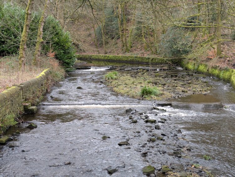
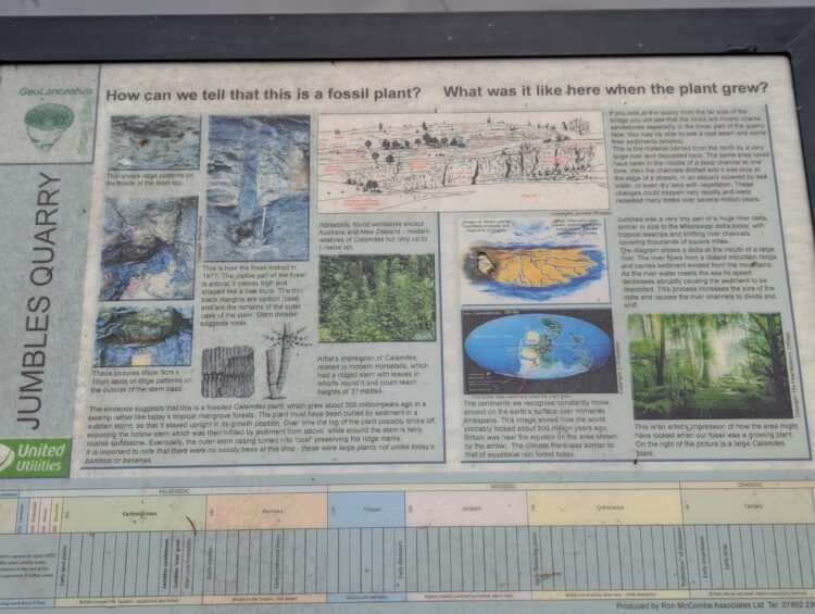
Jumbles Reservoir
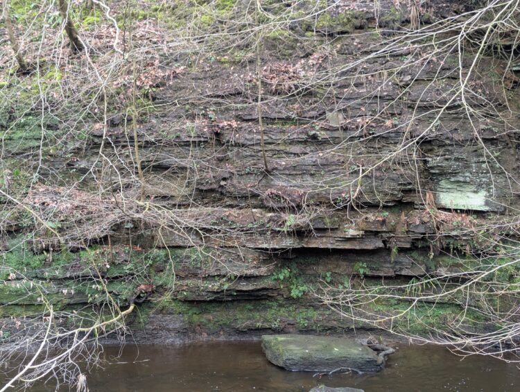
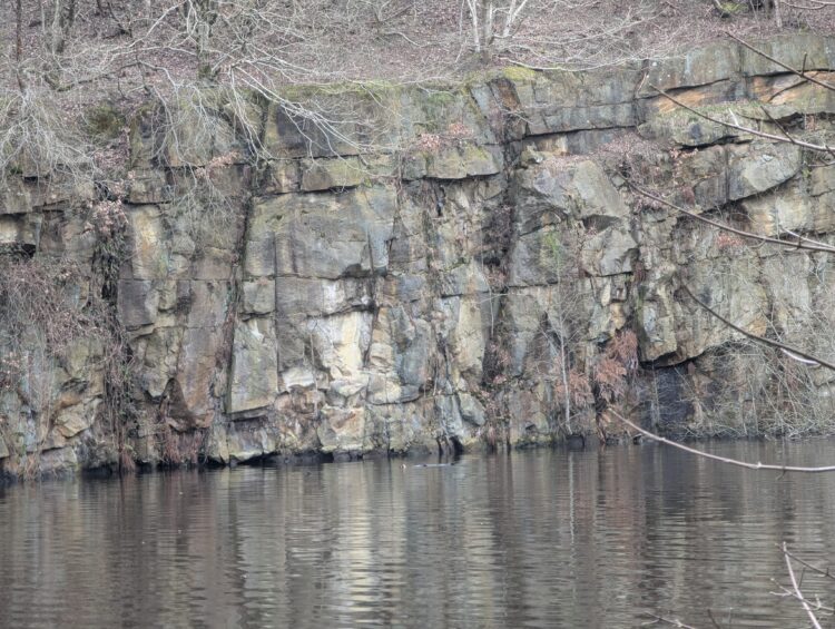
From there, the path follows the outflow from Wayoh Reservoir to the final reservoir of the day, Jumbles. The path passes through the part flooded Jumbles quarry, where an information board will help you pick out fossilised trees in the quarry face opposite the path.
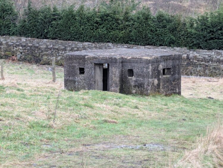
I then headed across the bridge at the ‘neck’ of the reservoir and up the bank towards the B6391. This path passes a Second World War pillbox. Many of these pillboxes remain in the countryside and some were paid for by subscription from local churches.
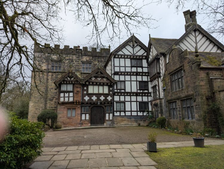
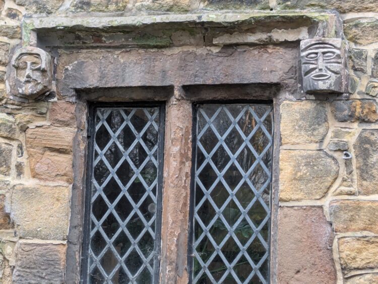
Turton Tower
On reaching the road I turned left and then right to enter Turton Tower. The stone tower was built in the 1420s, although the manor was held by the de Torboc family from 1212. Many alterations have been made over the years. It is now open to the public and has a tea room, a very convenient toilet and, reputedly, beautiful gardens.
The Final Stretch
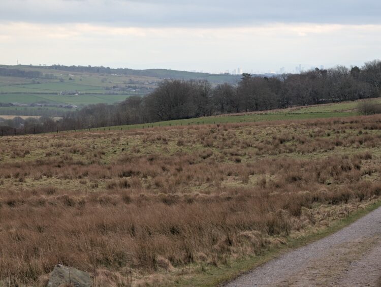
On leaving the tower, I turned right up the hill to cross the railway again and then turned right to walk past Clough House Farm and return to my starting point. I have done this walk many times and I always find something new and this day was no exception. As I walked on, I turned and I could clearly see central Manchester in the distance.
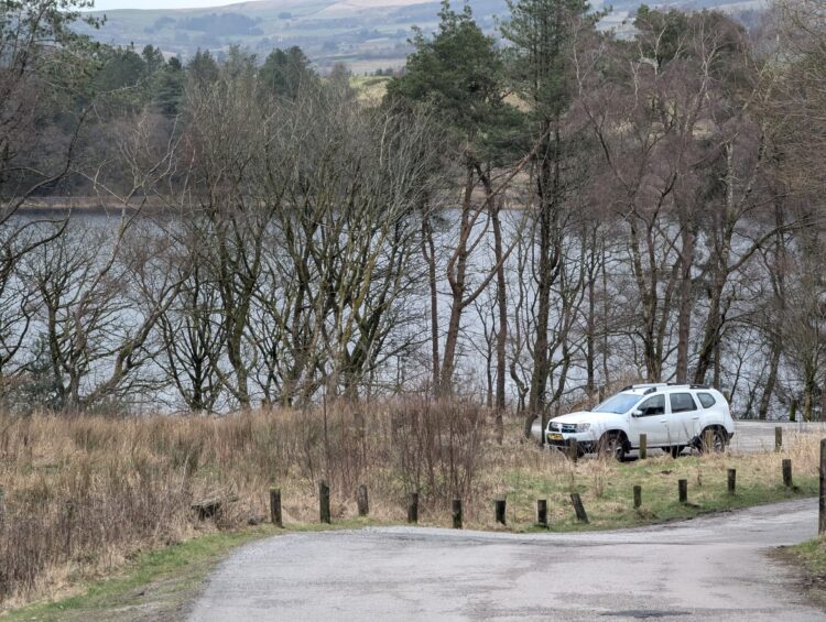
After this it was through the small plantation, down the hill towards reservoir number 1 and back to Duggee the Duster. This is definitely my favourite walk within 40 minutes of Lytham. There are lots of ways of lengthening or shortening this 8 mile route. Just get out the West Pennine Moors OS Explorer Map and enjoy yourself.
This post also covers The Warpers Trail.
The Beamers Trail is another section of the Witton Weaver’s Way. This post covers the same ground.