The Witton Weavers Way 1
The Witton weavers were not a specific group of people, but rather a term used to refer to the hand loom weavers from Witton near Blackburn. The Witton Weavers were among many Lancashire textile workers who were replaced by industrialisation and modernisation of the industry in the 19th century.
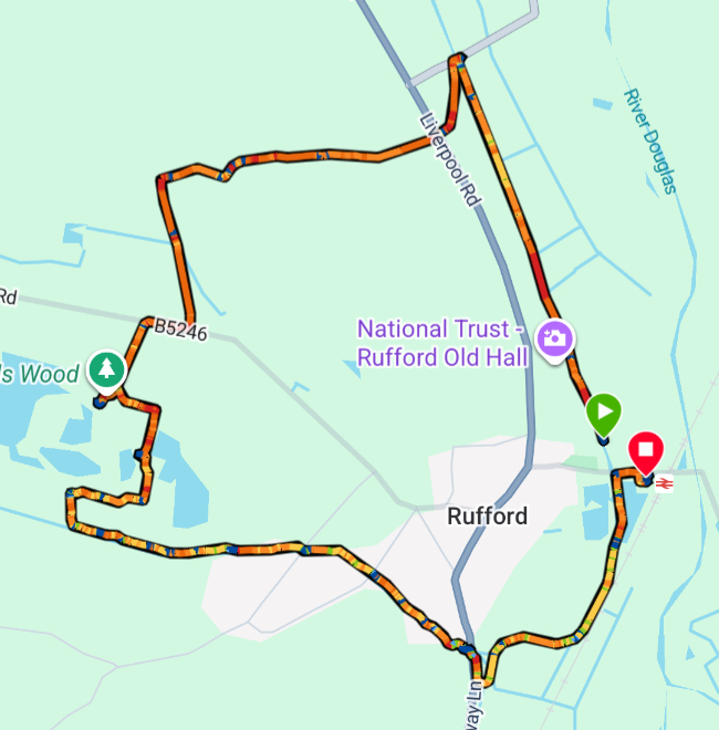
The Witton Weavers Way is a 32 mile trail around Blackburn and Darwen created to celebrate the areas industrial heritage and natural beauty.
The Beamers Trail
The Beamers Trail starts in Witton Country Park on the western side of Blackburn. It climbs to Billinge Hill and then gradually drops into the valley of the River Darwen The trail follows the river into Hoghton Bottoms before turning left to Pleasington and thence back to Witton Country Park.
Bank Holiday Monday was cloudy and a bit chilly but we headed off to do The Beamers Trail. We arrived at Witton Country Park to find a fair/concert/market setting up to celebrate VE Day.
I had printed out the official route for the trail but unfortunately, each time we went astray, it seemed to be because the directions were imprecise (at least that’s my excuse!). Thankfully the Ordnance Survey came to the rescue.
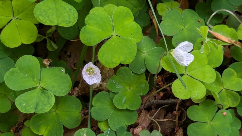
We eventually found one path out of several hundred which actually led us up to Billinge Hill. It was very beautiful walking through the woods but could have been more direct, however we did have a fairly close encounter with a barn owl.
Heading to the River Darwen
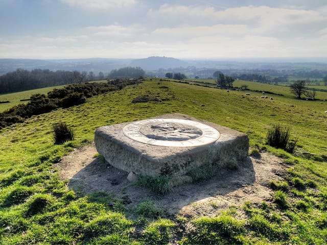
Leaving Billinge Hill, which is heavily wooded, the views across the Ribble Valley, to the north opened up, with the Bowland Fells clearly visible across the valley. The hills we were walking on are called the Yellow Hills because of the covering of gorse on the southern side.

We passed the memorial to Alfred Wainwright, a bronze portrait of Wainwright set in a slab of gritstone which was unveiled in 2013
Following this the path continues to fall towards the River Darwen, which provides a beautiful route back towards Pleasington and The Butlers Arms, a perfect stop for a pint.

The Final Mile
After this it is a half hour stroll through farmland across playing fields back to the car park at Witton Country Park.
My Garmin watch thingy made it just on 7 miles although the official route leaflet says it is 6. Please don’t attempt this without an Ordnance Survey map as following the route in the leaflet was quite confusing in places.
Despite the route finding failures, we had a lovely day in beautiful countryside and all within 5 miles of Blackburn town centre.

Looks great