Tag: Witton Weavers Way

  • The Beamers Trail

    The Beamers Trail

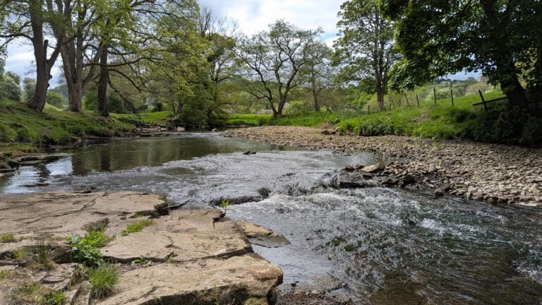
    A group of three or four of us try to meet once a month for a walk. It’s a bit weather dependent but usually takes place on the first Wednesday of the month. Our walk for October found us in Witton Park in Blackburn, repeating a walk that Heather and I had done in May. Unfortunately, the weather wasn’t quite as good, but The Beamers’ Trail is a good one in most weather conditions.

    Witton Park is a huge green space on the edge of Blackburn. There are paths, playgrounds, sports pitches and woods and, also a café. This was supposed to be open according to the park’s website. Unfortunately, it wasn’t. Anyway, forgoing the bacon sandwich and cup of tea that we were hoping for, off we went.

    The trail heads up from the park through woods. First through Big Cover Wood and then on to Billinge Hill and Billinge Wood. As at Hardcastle crags a couple of days earlier, the leaves were just beginning to turn. Everywhere was wet, but the rain that had threatened held off all day.

    Leaving Billinge Wood, the path crosses open fields to the Wainwright Memorial, where we paused for a chat with a local bloke who was sitting watching the world go by. Moving on we wound through bits of woodland and across fields and then down into the valley of the River Darwen. It was in one of the wooded areas that we came across the fungi pictured here. They are apparently Amanita muscaria or Fly Agaric. They are considered poisonous and are not to be eaten!

    We saw very few people on the walk, but this is one of the joys of mid-week walking, particularly out of school holidays.

    The path follows the river for a while before climbing past Pleasington Golf Club to Throstle Nest Brow and then dropping down into Pleasington Village and The Butlers Arms. Please note that, according to the gentleman we met by the Wainwright memorial, Pleasington isn’t pronounced Pleasington but Plesington. The beer in the Butlers Arms is highly commended, and my walking comrades tell me that the cake is good too.

    From here, it’s all downhill to the western end of Witton Park and the River Darwen and then a gentle stroll by the river back to the cars. It is just over 6 miles depending on how lost you get in the woods at the beginning of the trail. Ideally, it would have a café that was open as advertised but The Butler’s Arms made up for it and we all had food with us.

    Thanks to John, Neil and David for being such good company. I’m reasonably happy to walk alone but our impression of Compo, Clegg and Foggy is much more enjoyable. Does this make me Eli or Barry?

    Thanks to Mr. J. Cairns for 2 of these photos.

  • The Witton Weavers Way 1

    The Witton weavers were not a specific group of people, but rather a term used to refer to the hand loom weavers from Witton near Blackburn. The Witton Weavers were among many Lancashire textile workers who were replaced by industrialisation and modernisation of the industry in the 19th century.

    The Witton Weavers Way is a 32 mile trail around Blackburn and Darwen created to celebrate the areas industrial heritage and natural beauty.

    The Beamers Trail

    The Beamers Trail starts in Witton Country Park on the western side of Blackburn. It climbs to Billinge Hill and then gradually drops into the valley of the River Darwen The trail follows the river into Hoghton Bottoms before turning left to Pleasington and thence back to Witton Country Park.

    Bank Holiday Monday was cloudy and a bit chilly but we headed off to do The Beamers Trail. We arrived at Witton Country Park to find a fair/concert/market setting up to celebrate VE Day.

    I had printed out the official route for the trail but unfortunately, each time we went astray, it seemed to be because the directions were imprecise (at least that’s my excuse!). Thankfully the Ordnance Survey came to the rescue.

    We eventually found one path out of several hundred which actually led us up to Billinge Hill. It was very beautiful walking through the woods but could have been more direct, however we did have a fairly close encounter with a barn owl.

    Heading to the River Darwen

    Leaving Billinge Hill, which is heavily wooded, the views across the Ribble Valley, to the north opened up, with the Bowland Fells clearly visible across the valley. The hills we were walking on are called the Yellow Hills because of the covering of gorse on the southern side.

    We passed the memorial to Alfred Wainwright, a bronze portrait of Wainwright set in a slab of gritstone which was unveiled in 2013

    Following this the path continues to fall towards the River Darwen, which provides a beautiful route back towards Pleasington and The Butlers Arms, a perfect stop for a pint.

    The Final Mile

    After this it is a half hour stroll through farmland across playing fields back to the car park at Witton Country Park.

    My Garmin watch thingy made it just on 7 miles although the official route leaflet says it is 6. Please don’t attempt this without an Ordnance Survey map as following the route in the leaflet was quite confusing in places.

    Despite the route finding failures, we had a lovely day in beautiful countryside and all within 5 miles of Blackburn town centre.

    Other Walks in the Area

    Beacon Fell

    Turton and Entwistle Reservoir

  • You Make the Path by Walking

    This is, more or less the walk we did yesterday. It’s 5.5 miles, but there are loads of variations to make it shorter or longer, all helped by 2 nice pubs. The Black Bull, just off the path in Edgworth, and The Strawbury Duck, next to Entwistle Station.

    The Wader

    The Wader is a 10foot tall heron, sculpted in galvanised mild steel by the British based Dutch artist Marjan Wouda. It has been a feature of the northern shore of the reservoir since 2008 and depicts a heron patiently waiting for its prey. The stick in the heron’s beak is, apparently, a stick and is a recent, unofficial addition.

    The title of the post comes from a poem by Antonio Machado: ‘No hay camino, se hace camino al andar’, which roughly tramslates as “There is no path, you make the path by walking”. It’s been a favourite of mine since about the time of my diagnosis. It seems to sum up the random twists and turns of life. It’s also been an encouragement to keep on walking as an aid to my health, both physical and mental.

    Yesterday I finished my January walking challenge for Prostate Cancer UK. Over the month I’ve walked almost 61miles and raised just over £500. I’m really grateful to all of the people who have donated money to this cause, and also grateful to the people who have accompanied me on various walks, particularly my wonderful wife, who did most with me, but also to the two David S’s and also Neil M who helped out on a walk around Rivington (David S) and yesterday’s walk at Edgworth (the other David S and Neil). I’ve ended January in a much more upbeat frame of mind than usual and I’m looking forward to continuing my walking through February.

    David S and Neil post rag pudding

    Having said all that, today is a beautiful day and I should be out for a walk but I’m feeling a bit knackered. It’s hard to believe that it’s 8.5 years since Heather and I were walking 12-15 miles a day across Northern Spain on the Camino de Santiago de Compostela. I must be getting old.

    Musical link this time is from the late, totally brilliant Kirsty McColl. It also has a Spanish connection in the chorus. Here are the words, so you can join in:

    No le gusta caminar
    No puede montar a caballo
    Cómo se puede bailar
    Es un escándalo

  • Rag Pudding Mama

    Turton & Entwistle Reservoir – Base for the famous Rag Pudding walk

    A fine day today, so Heather and I went off to Darwen to do the walk around the reservoirs, and, just for once, we took a packed lunch hence avoiding the Black Bull’s culinary masterpiece.

    For those of you unfamiliar with the area, which is just of the A666 between Darwen and Bolton, there are three large, connected reservoirs in the valley. Turton & Entwistle, Wayoh and Jumbles as well as several smaller ones. These supply Bolton and surrounding areas with water.

    The dam at the eastern end of the Turton & Entwistle reservoir was built in 1832 and was the first in the UK to exceed a height of 100 feet.

    Wayoh reservoir was completed in 1876 and enlarged in 1962.

    Jumbles was opened in March 1971 by Queen Elizabeth II. At its northern end is Jumbles quarry which is now flooded by the reservoir. The name Jumbles is thought to derive from a northern English term from the 19th century, ‘dumbles’, meaning a ravine like valley with wooded sides and a fast flowing stream. Never heard of it myself and I’m very old!

    Armsgrove or Entwistle viaduct carries the railway line from Bolton to Blackburn. The area also carries remnants of a Roman road which ran from Manchester to Ribchester and there are traces of a Roman fort, probably a way station, at Edgworth.

    Isn’t the internet wonderful?!