Exploring Preston
The most recent outing for the Fairhaven Methodist Church Walking Group took place on Monday, September 14th when 5 explorers hit the bus routes of Lancashire to rendezvous at the brutallist masterpiece which is Preston Bus Station. We had been promised showers, rain, sunshine and most things in between, but the afternoon was warm and sunny and perfect for a walk.
The Preston Guild Hall is closed primarily due to legal disputes with its former operator and the subsequent discovery of dangerous Reinforced Autoclaved Aerated Concrete (RAAC) in the roof.
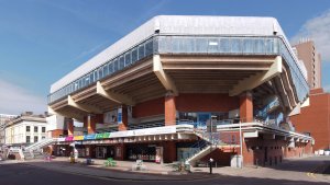
Walking from the bus station down towards the Flag Market, we passed the Guildhall. Sadly the main theatre and Charter Theatre are both closed although some events are hosted in a space on the first floor which I think is the area that used to house the theatre bar.
We continued to The Flag Market.
The Flag Market is dominated by two of Preston’s greatest institutions. The Harris Museum and Spud Bros baked potato van. Seriously though, the Harris is worth half a day of anyone’s time. As well as a fascinating collection of permanent displays there are often special featured displays to keep you occupied.
We continued on to Fishergate and headed downhill to Winkley Street and then through into the Georgian splendour of Winkley Square and Gardens.
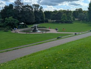
Avenham and Miller parks date back to the 1860s. At the time the American Civil War was disrupting supplies of cotton to the cotton towns of the north west. The land for Miller Park (the area closer to the railway bridge) was donated by a local cotton manufacturer, Thomas Miller. Many people were thrown out of work by what became known as the cotton famine. Local philanthropist and social reformer, Joseph Livesey, with associates formed a committee to carry out public works thus employing out of work cotton workers and Avenham and Miller parks were created.
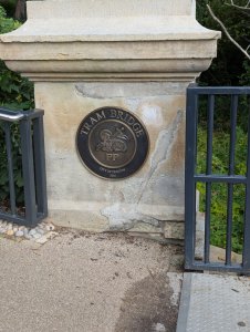
We walked down to the banks of the River Ribble and walked upstream to arrive at the new Tram Bridge. Preston’s new Tram Bridge officially reopened to the public on May 22, 2026, following a complete rebuild that spanned seven years after the original 200-year-old structure closed in 2019. It links Avenham Park to Penwortham, on the south side of the Ribble.
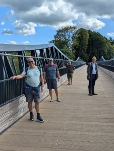
From the Tram Bridge we headed east, through farmland, to the confluence of the River Darwen and the River Ribble. We then turned to walk along the River Darwen for a while and then crossed to reach Walton Bridge, where we crossed the Ribble again to the northern bank and then headed west along the river, through Frenchwood to return to Avenham park. Neil, our leader, took us on a short mountaineering course to prove we were, in fact, in a river valley, before we headed back up into the town.
Some of the housing above Avenham Park is in need of attention. Many of the larger buildings are being converted into flats, The for sale board shown here is for one such!
From here we walked back through Preston to the bus station to catch the bus home.
In round about 5.5 miles we went from 1970s brutalism to Georgian splendour to 19th century philanthropy and 21st century renewal. A fascinating walk.
The Tram Bridge – A Bit of History
As I’m not a native of Preston, I was a bit puzzled about the Tram Bridge, largely because it seemed to be in a strange place to construct a crossing for trams. The hill down to the bridge out of Preston is quite steep. Anyway, I did a bit of research using my friend Gemini and found the following.
The Tram Bridge in Preston is so named because it was originally built to carry an industrial plateway—known as a tram road or tramway—across the River Ribble.
History Behind the Name
- The Canal Gap: In the late 1790s, the Lancaster Canal Company was constructing a waterway link from Kendal down to Wigan. However, building a massive stone aqueduct across the wide Ribble Valley in Preston proved far too expensive.
- The “Temporary” Solution: To connect the northern section of the canal (at Preston) to the southern section (at Walton Summit), the engineers designed a 5-mile horse-drawn plateway/tramway instead.
- The Bridge (1803–1804): The bridge opened around 1803–1804 specifically to take these horse-drawn tram wagons over the river.
The iron wagons ran on L-shaped cast-iron tracks laid across the bridge. Although the tramway closed in 1859 after railways rendered it obsolete, the crossing point retained the name “Tram Bridge” among locals.
Over the decades, the original wooden trestle bridge was rebuilt and modified into a pedestrian bridge. After closing due to safety concerns in 2019, a modern replacement footbridge was constructed, preserving both the historic name and the original crossing route.